MagLog
from Geometrics
MagLog is an advanced geophysical data logging software package for serial, USB and network interfaced instruments. fundamentally designed for Airborne and Marine data acquisition in which multiple data sources required accurate time synchronisation.
MagLogLite TM offer all the necessary features required to preform Marine and land based surveys, whereas MagLogPro reserves specific features for Advanced system configurations.

This software requires a paid license, demo license available. Download MagLog.
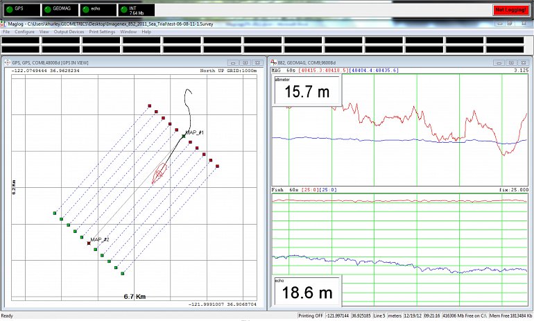
MagLogLite offers the marine or land survey operator an easy to use yet sophisticated data logging and display controller. MagLogLite boasts superior data handling capabilities for logging, displaying and printing multi-channel asynchronous data transmissions. Single sensor or multi-sensor gradiometer arrays with depth, altitude and/or differential GPS track on map overlays are easily configured for storing to disk, display and printing using the new step-by-step Configuration Wizard.

Features
MagLogLite
- Designed with a Configuration Wizard for automatic setup of Marine and Vehicle survey operations.
- Includes Directory of common instrument communication protocols.
- Instrument protocols can be set manually for unsupported devices.
- Mini-window displays provide a flexible representation of data.
- Real-time diagnostics performed on all data inputs, providing audio alarms as immediate feedback if data is not being transmitted, is out of range or fails other quality criteria.
- Layback calculations and coordinate transformation.
MagLogPro
Includes all of the above, plus;
- Real-time data output to another computer or central data centre via TCP/IP network connection.
- Incorporation of cable counter distances for real-time layback calculation.
- Supports Gyro devises to correct layback error during turns (particularly important to Multi sensor marine arrays with wide swath width)
- Supports USBL (ultra sort baseline) tracking devices.
- Supports additional 3rd party instrumentation like Gamma Ray Spectrometers and EM61MK2.
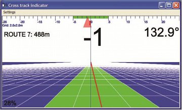
3D highway steering window for navigating along predefined survey routes. Data logging can be automatically terminated once the vehicle reaches the endpoint of the route. Cross track errors are calculated in real time to relay line deviations so the pilot can actively adjust the heading to return on the line. Users can include an acceptable line offset before an error message appears to inform the pilot to shift back towards the survey route.
Technical Specifications
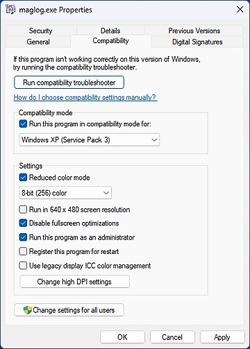
| Operating System: | Windows xp- Windows 10. |
|---|---|
| Versions: | MagLogLite MagLogPro |
| Protection: | USB Key Lock dongle, or time limited activation code. |
Data Sheet
- MagLog Datasheet (PDF)


